Drone News
Bathydrone Underwater Surveying Drone – DRONELIFE

 Aurigo Software, University of Florida Partner for New Underwater Surveying Drone System
by DRONELIFE Staff Writer Ian M. Crosby
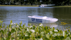
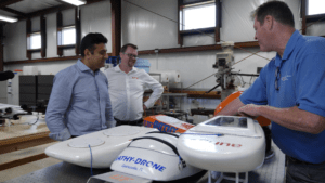
Capital planning and construction management software leader Aurigo Software has announced a partnership with the University of Florida’s Department of Mechanical and Aerospace Engineering for the development of Bathydrone, a new system for underwater surveying, mapping, and inspection.
Currently, collecting data for underwater construction or inspecting existing assets involves manual surveying or boat-mounted survey sensors. The Bathydrone system deploys a drone carrying a small vessel equipped with a COTS sonar unit, removing the need for manual surveying. The sonar unit features down-scan, side-scan, and chirp capabilities and logs data within the hull’s onboard console, which can be retrieved post-mission and plotted in various ways.
 “We are excited to be working on this…
Source: dronelife.com


