Drone News
Drone Reality Show Pearl River

 Drone Reality Show Follows Surveying of the Pearl River by Land, Water, and Air
by DRONELIFE Staff Writer Ian M. Crosby
Tice Engineering has conducted a surveying project of 150 acres surrounding Jackson, Mississippi’s Pearl River to examine flood zones and inspect Bridge scour. The team’s efforts are documented in “Down to Earth,” a three-episode series demonstrating how real surveyors collect data and convert it into deliverables in spite of challenging and dangerous conditions.
The series follows the Tice team as they scan over and under local infrastructure and under the water bordering the bridge foundations. To complete the job and create a highly detailed 3D surface, Tice will deploy an airborne Lidar drone, terrestrial scanning on the ground, and hydrographic scanning under the water.
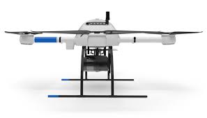
The first episode sees the Tice Team start the survey process by deploying a Z-Boat to scan under the water and the mdLiDAR1000HR to scan from the air. “Tice…
Source: dronelife.com


