Drone News
Measuring Global Ice Melt – Inside Unmanned Systems

Drones become tool of choice in monitoring threatened glaciers and ice sheets.
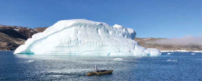
Icebergs breaking off from the Greenland ice sheet are rapidly melting because of climate change—part of a massive wave of ice loss that could trigger nearly a foot of global sea level rise. Measuring these large pieces of moving ice to determine how quickly they are shrinking, however, has long been a challenge.
Over the past decade, researchers have turned to drone technology to monitor melting ice in remote corners of the world. In Greenland, for example, a team from Northeastern University has deployed a kayak-sized unmanned surface vessel to navigate around icebergs, equipped with a camera to capture images of the structure above the water and a sonar sensor to measure the submerged…
Source: news.google.com


