Drone News
Best mapping drones: flat maps, 3D mapping and more


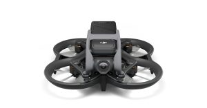
The very best drones for mapping are some powerful commercial machines. Custom-built, high-end drones can be configured exactly how you need them, which is great, but we’re here today to show you some off-the-shelf machines that can help you out. Here are some of the best consumer-level mapping drones.
We’d also like to point out that mapping, for drones, is a diverse topic. Some may be looking to map an area of the ground, like a traditional map, while others may be going vertical with 3D mapping of a building or structure. All of these drones can capture photos of the ground and can either stitch them together themselves or utilize a third-party service to tackle the mapping, the same goes for 3D mapping a building, but more likely than not you’ll need third party software, such as Pix4D.
Why trust Drone Rush?
I’ve been a fan of flight since a young age; while I’ve had few opportunities at the helm of manned aircraft, the hours on…
Source: www.dronerush.com


