Drone News
CHEESEHEAD Drone Project May Improve Climate Models

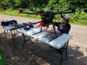
Source: Routescene
What do the Green Bay Packers and forest-scanning drones have in common? Cheeseheads.
While Packer fans proudly identify with the dairy-infused moniker, a research project at the University of Wisconsin-Madison has adapted the name for a ground-breaking UAV project to improve weather forecasting by understanding how vegetation and forests influence the atmosphere.
CHEESEHEAD (Chequamegon Heterogeneous Ecosystem Energy-balance Study Enabled by a High-density Extensive Array of Detectors) aims to study interactions and feedbacks between the land surface and atmosphere and how these results can be used to optimize climate models. The result? Better carbon-emission reduction policy making.
Researchers are using Routescene’s UAV LiDAR system to collect high-density, 3D point cloud data of prominent tree species in the Chequamegon-Nicolet National Forest. Routescene’s LiDAR system mounted on a drone can capture the full tree structure from the tree canopy to the…
Source: dronelife.com


